A Collaboration among Scientists Brings New Insights
By Dustin Solberg
A scientist named Melanie Smith recently drew up a map of a particular tract of public land in Alaska’s far north. Look closely and you’ll see villages: Nuiqsut, Wainwright, and Atqasuk. You may notice, too, that though this map covers an area the size of Maine, there are no roads that criss-cross it. The roads and pipelines of oil developments at Prudhoe Bay lie to the east, far beyond the flat horizon of the coastal plain. The Arctic National Wildlife Refuge is even farther east, more than 100 miles from here.
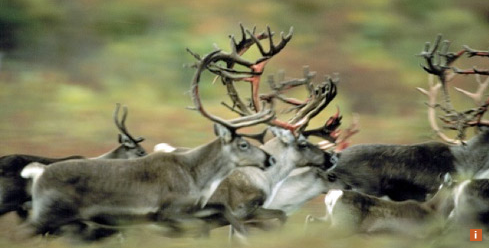
Caribou range freely across this vast tract, as do brown bears and wolves. This is where dozens of bird species – peregrine falcons, snowy owls and a wide array of waterfowl and shorebirds – fledge their chicks. And for the people who live here, nature provides in a way that hearkens back to an earlier time. In Inupiaq villages, subsistence harvesting of traditional foods – including caribou – is a vital part of Native culture. Caribou stew is often what’s for dinner.
In Alaska, this intimate relationship between people and nature wouldn’t be possible without expanses of intact habitat. To ensure that caribou habitat remains healthy, The Nature Conservancy has helped organize research that marries cutting-edge computer analysis and several decades of biologists’ field studies of the Teshekpuk and Western Arctic caribou herds (with populations of 64,000 and 348,000, respectively). Ultimately, the scientists seek to ensure the long-term health of caribou herds so this unique relationship between caribou and the people of the region’s Inupiaq villages is maintained.
In Data, She Sees a Story
Smith is trained as a landscape ecologist, meaning she’s fluent in a mishmash of cartography, computer modeling, ecology and land management. She designs her maps from her desk at the office of Audubon Alaska in downtown Anchorage, 600 miles south of the caribou. If you were to drop in on her, you may catch her listening to an iPod loaded with the Decemberists, Neko Case, and the like, with a steaming cup of peppermint tea at her side.
Her task, together with ecological modeler Ryan Wilson of The Wilderness Society, who led significant pieces of this work, is to build on data gathered by caribou biologists like Jim Dau and Lincoln Parrett from the Alaska Department of Fish and Game.
Parrett, who studies the Teshekpuk herd, teams up with a helicopter pilot to briefly capture individual caribou with a hand-held net gun – deployed while leaning from the helicopter. Once a caribou is netted, the helicopter lands and Parrett collars the animal with a GPS tracking device weighing 1.85 pounds.
These individual caribou supply vital information about the annual movements of the herd. This includes knowing where the Teshekpuk caribou are during calving season – the most sensitive time of year.
From the vantage point supplied by years of GPS data and the processing power of a desktop computer, a landscape ecologist considers questions in space and time. In this instance, that’s “What do calving caribou need?” and “When do they need it?”
As female caribou prepare to give birth and then nurse newly born calves, they need the most nutritious diet available. A significant part of the diet is newly sprouted cotton grass in early June – when it’s “in-season.”
“They’re keying off whatever is most nutritious at that time,” Parrett says.
In addition to perfect nutrition, caribou need a place without predators such as wolves.
“They’re trying to offset those two things,” Parrett says, and that is what brings them to the map area marked in red, which bumps up against Teshekpuk Lake.
“Once we used the mapping tools to show us all the places that the Teshekpuk herd would find suitable for calving, what we learned is it’s really all about Teshekpuk Lake,” Smith says. “This area offers excellent calving habitat.”
This may prove critical. This Arctic wilderness was set aside by executive order in the 1920s – not for caribou but for its oil and gas. Now known as the National Petroleum Reserve-Alaska, drilling here appears more likely than ever.
“If development is to occur in the reserve, we want to ensure that policy makers have the best possible data on caribou calving habitat,” says the Conservancy’s Evie Witten, who helped organize the collaborative habitat study. “Before developers draw up plans for the infrastructure of roads and pipelines that energy development requires, we need to understand and plan for the critical needs of caribou. The future of the Teshekpuk herd and the cultural ties of the Inupiat people depend on it. Our habitat analysis and decision support tool provides crucial understanding.”
This larger research effort includes partners from Alaska Department of Fish and Game, Audubon Alaska, Bureau of Land Management, ConocoPhilips, North Slope Borough, and The Wilderness Society.
“Everyone involved has an interest in long-term conservation. We know caribou are sensitive to development and infrastructure during part of their yearly cycle, particularly during calving. It’s not that caribou cannot exist with some level of development—it’s about places and it’s about timing,” says Smith. “Will a caribou cross a road when being harassed by hoards of insects? Sure. But will a caribou calve their young near an active oil field with traffic and small planes? That’s where the problems come in. We’re trying to identify key places to put the correct kind of conservation measures in place so that caribou will do well at those sensitive times of the year.”
The Nature Conservancy is the leading conservation organization working around the world to protect ecologically important lands and waters for nature and people.


