An effort to remap Alaska celebrated its half-way mark Tuesday during a ‘skybreaking’ ceremony in Anchorage. The remapping initiative is a significant undertaking for the state.
Alaska is 57 percent mapped. That’s the milestone celebrated today at the FedEx hangar in Anchorage. Interior Secretary Sally Jewell gave the keynote by telecast, and a handful of GIS big-wigs flew in for the event.

Nick Mastrodicasa with the Department of Transportation is one of the project’s leaders in Alaska:
“When this whole thing started in 2006 — it’s been 10 years almost — I found out that Mars was better mapped, and more recently mapped and more accurately mapped, than Alaska,” Mastrodicasa says.
A lot of the current mapping data used in Alaska is 40 to 50 years old. It was collected using manual cartography techniques that are now obsolete. One of the big drawbacks of that old data is that it isn’t always accurate.
Mastrodicasa describes it to Talk of Alaska host Steve Heimel during Tuesday’s Talk of Alaska program:
“There are some ridgelines we’ve seen that are a thousand meters off,” he says. “It’s not as bad as we originally thought, but it’s bad. We are seeing valleys that are horizontally displaced by half a mile.”
You probably get the picture that these kinds of mapping errors are a big deal if you’re a pilot. Stories of perfectly functional aircraft flying into mountainsides are tragically ubiquitous in Alaska.
For example, say you’re flying through mountainous terrain and your flight path suddenly gets socked in, you really want your GPS device to be accurate. A GPS device is only as dependable as the data behind it. And the new data being collected with this mapping initiative is accurate within millimeters.
Forty-one million dollars have been spent on the project so far, and that money is coming from a multitude of different state and federal agencies.
The data collection process is expensive. It involves a technology called IFSAR. Kevin Gallagher is the associate director of USGS’ Core Science Systems program. He explains:
“IFSAR is interferometric synthetic aperture radar,” he says. “It’s essentially a radar, but by projecting it at the ground and measuring the reflectance back, you get a very highly detailed elevation map.”
In addition to aviation, the high-quality data set also has significant implications for mineral development and resource management purposes.
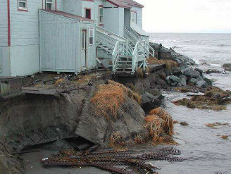
This data, Gallagher says, is going to become even more significant as climate change begins to reshape the north. Melting permafrost, land subsidence and erosion are poised to redefine Alaska’s terrain.
“Because the data we’re collecting now is going to serve as a baseline to understand the changes that are occurring out on the landscape.”
Gallagher hopes the remapping project will be finished within another 2 to 3 years , which will bring Alaska’s maps on par with those the Lower 48, and on Mars.


