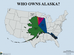
The national parks and refuges we enjoy today as outdoors people weren’t always destined to be conserved for these purposes. After Alaska became a state, the map was open as to which lands would be owned by Alaska Natives, the state government, or private owners. On the next show, we’ll look back into history, to the 1970s, to find out how it happened, as some lovers of Alaska’s wild places sat down with maps and drew lines that became the largest single conservation action in world history, called ANILCA. How did it happen, and how did they choose? On today’s show, my guests include those who made these decisions, including at the highest level, working with the President to the boots on the ground, exploring the watersheds of the Arctic to choose refuge boundaries.
HOST: Charles Wohlforth
GUESTS:
- Cecil Andrus– former governor of Idaho and Secretary of the Interior, responsible much of the legislation talked about in today’s show.
- Fran Mauer- wildlife biologist that worked with Fish and Wildlife Service on creating boundaries for ANILCA
LINKS:
- Description of ANICLA from Wikipedia
- ANILCA program website from the Alaska DNR
- Description of ANILCA from the Alaska DNR
- History of Wrangell-St. Elias National Park, as related to the creation of ANILCA
PARTICIPATE: Facebook: Outdoor Explorer (comments may be read on-air)
BROADCAST: Thursday, December 22, 2016. 2:00 pm – 3:00 p.m. AKT
REPEAT BROADCAST: Thursday, December 29, 2016. 8:00 – 9:00 p.m. AKT
SUBSCRIBE: Receive Outdoor Explorer automatically every week via
Go to OUTDOOREXPLORER.ORG
cwohlforth (at) alaskapublic (dot) org | About Charles


